Strata is Veracio’s powerful cloud-based solution designed to improve how geological data is captured, managed, and shared across drilling operations.
Strata allows users to create unified drill hole records and control who can access the data with customizable permissions.
Veracio’s field tools can connect directly to Strata, making it easy to upload and store geological data in a central cloud location. This connection supports consistent data alignment and maintains a clear chain of custody from field collection to cloud storage, ensuring transparency and accountability.
Strata features a user-friendly interface and multiple tiers administrator controls, allowing teams to manage data access confidently while maintaining strong security standards.
Strata with TruProbe Gyro Integration is the first release of Veracio’s unified cloud platform, providing dependable survey data management.
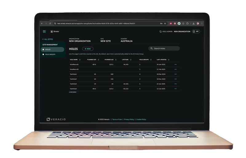
Centralized Hole Management
Synchronized hole records between Strata and TruProbe Gyro reduces field errors, ensuring more reliable data.
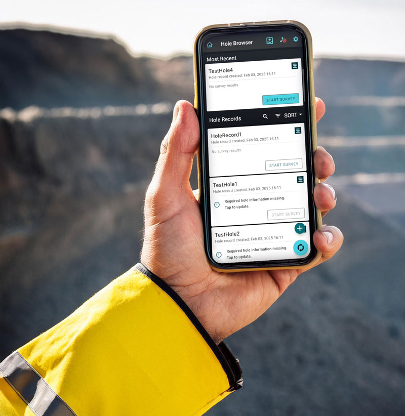
Intuitive Survey Workflow for Drillers
Drillers can sync hole records from Strata to TruProbe Gyro, survey the holes, and upload data back to Strata; resulting in a fully synchronized, efficient workflow.
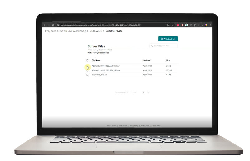
Instant Access to Survey Data
Download and view survey data sent from the field in the TruProbe Strata cloud app. With real-time access to accurate information, your team can make faster, more informed decisions.
Take full control of your data
Gain full control over managing the holes being surveyed via TruProbe® Gyro in Strata.
Centralized hole record management reduces administrative overhead and minimizes field operator errors, giving you more confidence in your data.
Effortless User Experience
The integration between Strata and TruProbe Gyro ensures smooth syncing of hole records between systems.
Quick Access to Survey Insights
Whether you need to visualize, download, or analyze your survey data, Strata gives you fast and easy access to the information you need, whenever you need it.
A simple, easy-to-use software for accessing your downhole data in the cloud.
Access is designed with a focus on user experience, ensuring ease of use when navigating to your data.
Versatile File Export
Access stands out by enabling users to export processed data in multiple, appropriate file formats, accommodating diverse analytical needs.