No two core samples are the same.
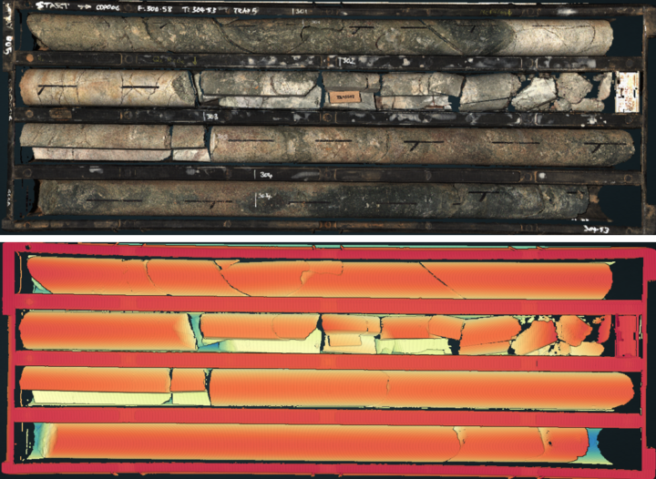
Advanced 3D laser profiling captures a high-resolution topographic model of each core tray before analysis begins. This digital foundation enables accurate, automated measurement and opens new possibilities for visualization and interpretation.
3D Topography & Bulk Density with Lidar
Lidar scanning generates a precise point cloud of the core in its tray, enabling accurate volume and bulk density calculations for detailed geological modeling.
True 3D Core Visualization
Each scan produces a colorized point cloud, delivering a full 3D representation of the core at sub-millimeter resolution. Veins, fractures, and surface textures are rendered in striking detail, making structural and lithological features easy to identify.
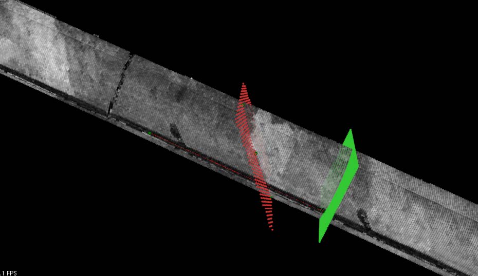
Fast, Accurate Structural Measurements
Alpha and beta angles of planar features can be measured directly from the digital core model—no handling required. Measurements are calculated using geometric relationships, with no need for sensor calibration, zeroing, or input of core dimensions. It’s a faster, safer, and more consistent approach to structural logging.
Digital, Connected, and Always Accessible
All measurements are stored digitally and tied directly to their position on the core. Reanalysis, adjustments, and QA/QC can be performed long after the cores are archived, and remote teams can easily collaborate using the digital dataset.
Efficiency Without Compromise
From full cores to cut samples, this laser-based method transforms structural logging into a streamlined, data-rich workflow—delivering speed, precision, and reliability in every scan.
Software Options
Veracio’s geological software provides solutions for logging and analysis using the captured lidar data.